American-funded conflict monitors release report with satellite photos
Detailed images of burned villages in Darfur
Yale University’s Humanitarian Research Lab has released a report documenting violations of the previous ceasefire and the May 11 declaration of principles signed by RSF and SAF in Jeddah.
The report was a collaboration with commercial satellite imagery companies Esri and PlanetScape Ai, with funding from the U.S. Department of State’s Bureau of Conflict and Stabilization Operations.
In a press release, the State Department said it would continue monitoring the conflict using satellite photos and open-source data analysis. The project is called “Sudan Conflict Observatory.”
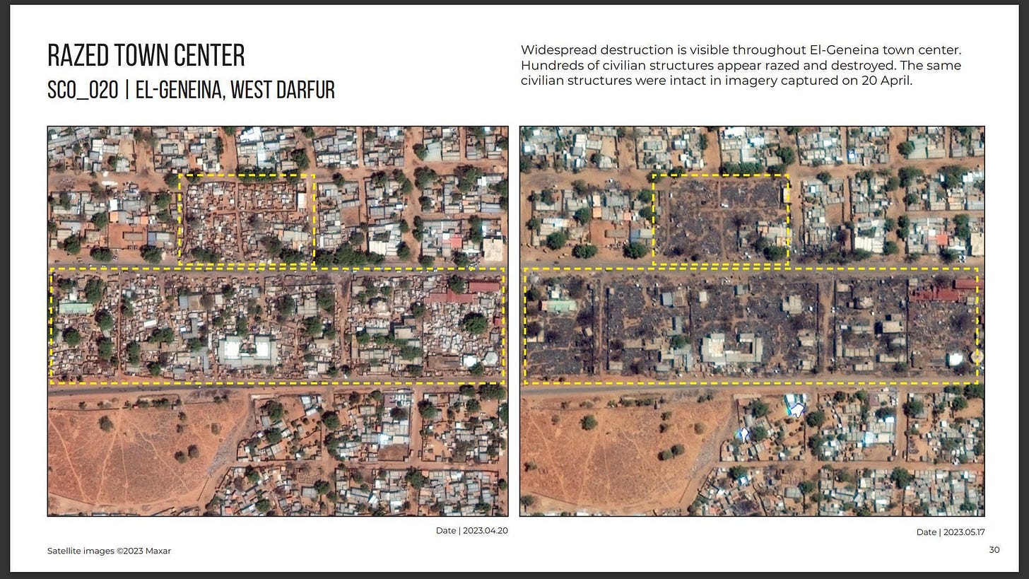
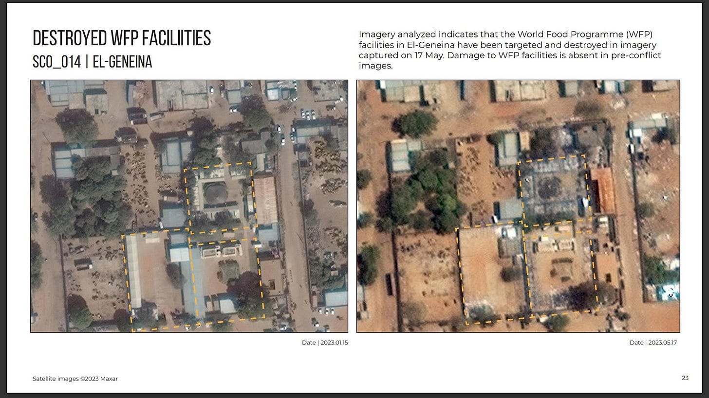
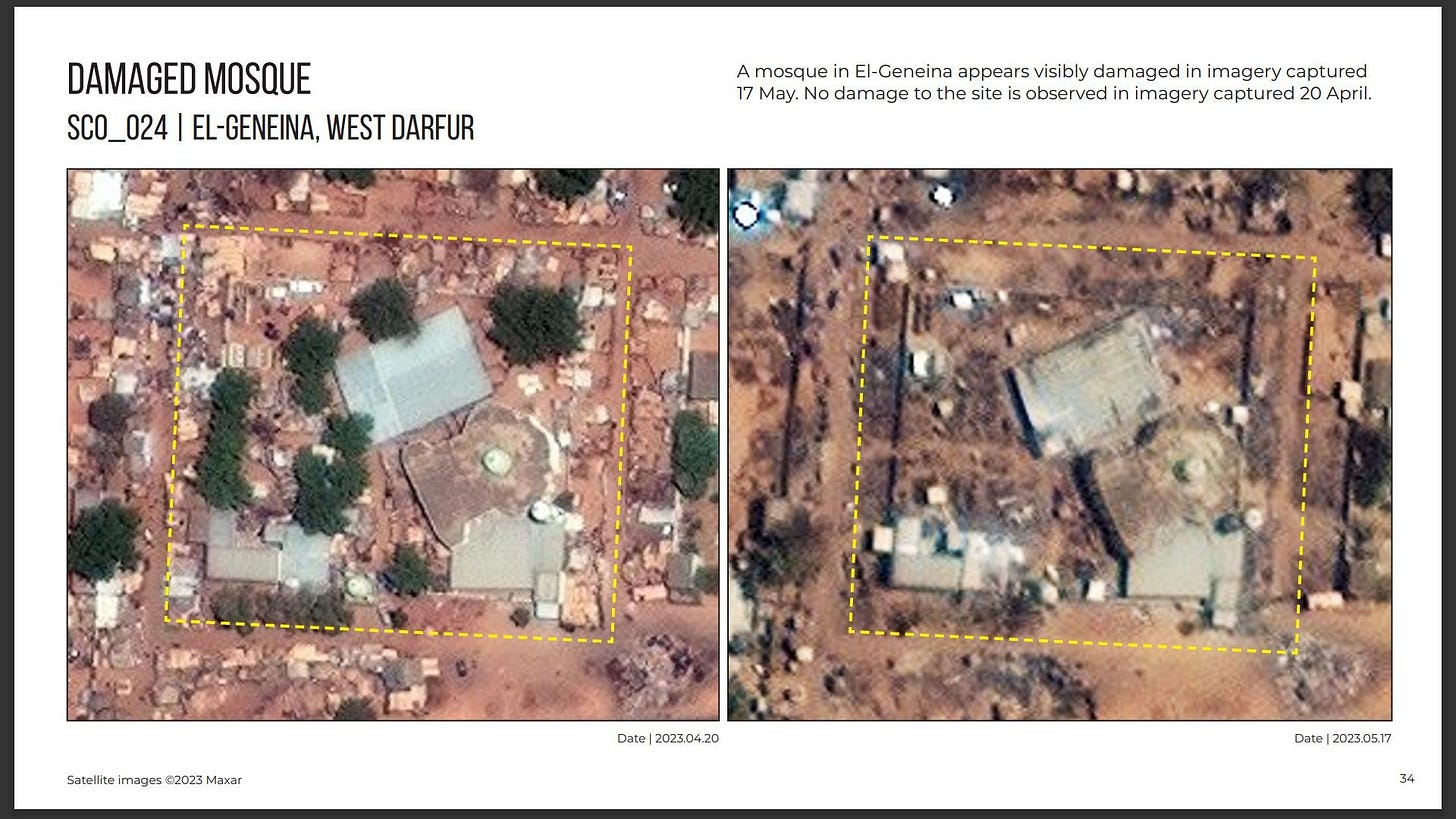
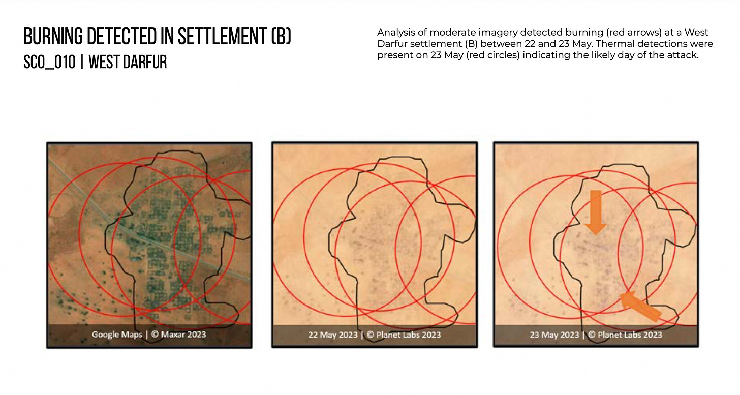
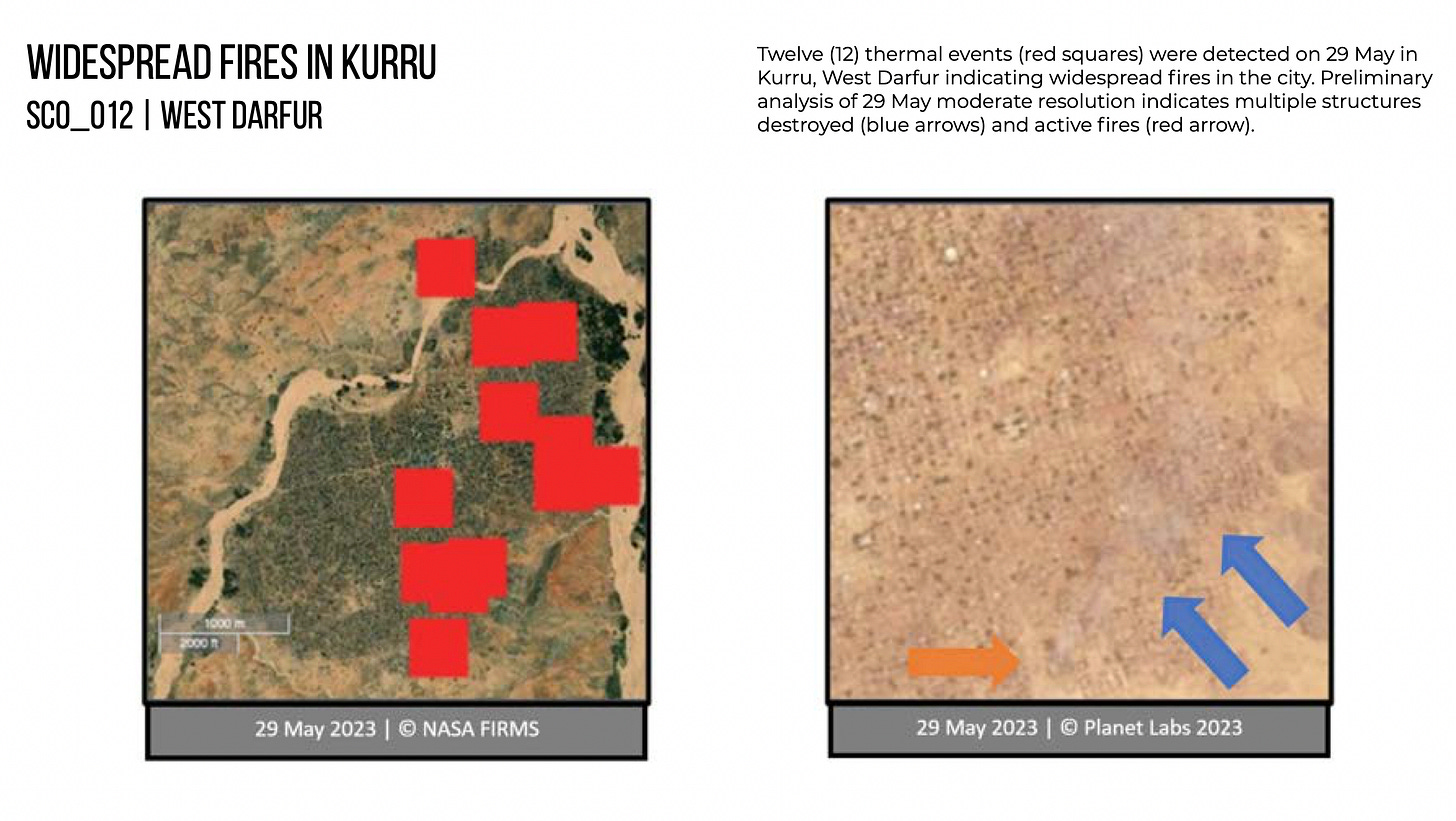
The 40-page report includes satellite images of burned villages in Darfur as well as El Geneina, some of which OSINT analysts on Twitter have already identified, and some of which is new information.
The American-funded monitors said they had confirmed eight “systematic arson attacks reportedly by the RSF across Darfur’s rural villages and urban centers.” However, the report noted that it is difficult to verify the precise time of the attacks or the responsible party because of a lack of information.
Additional violations included attacks on civilian infrastructure in Khartoum, and obstruction of civilian movement by the parties to the conflict by blocking bridges. These violations likewise have already been reported in the news media or on social media. Below are a selection of photos from the report:
Attacks on Civilian Infrastructure in El Geneina, West Darfur
Attacks on Villages in Darfur
The full report is available for download here.


