

Investigating the Flames at Dal Group Farm
A Tale of Systematic Fire and Combat Activity
By Faisal Mohamed Elsheikh
Place of Interest
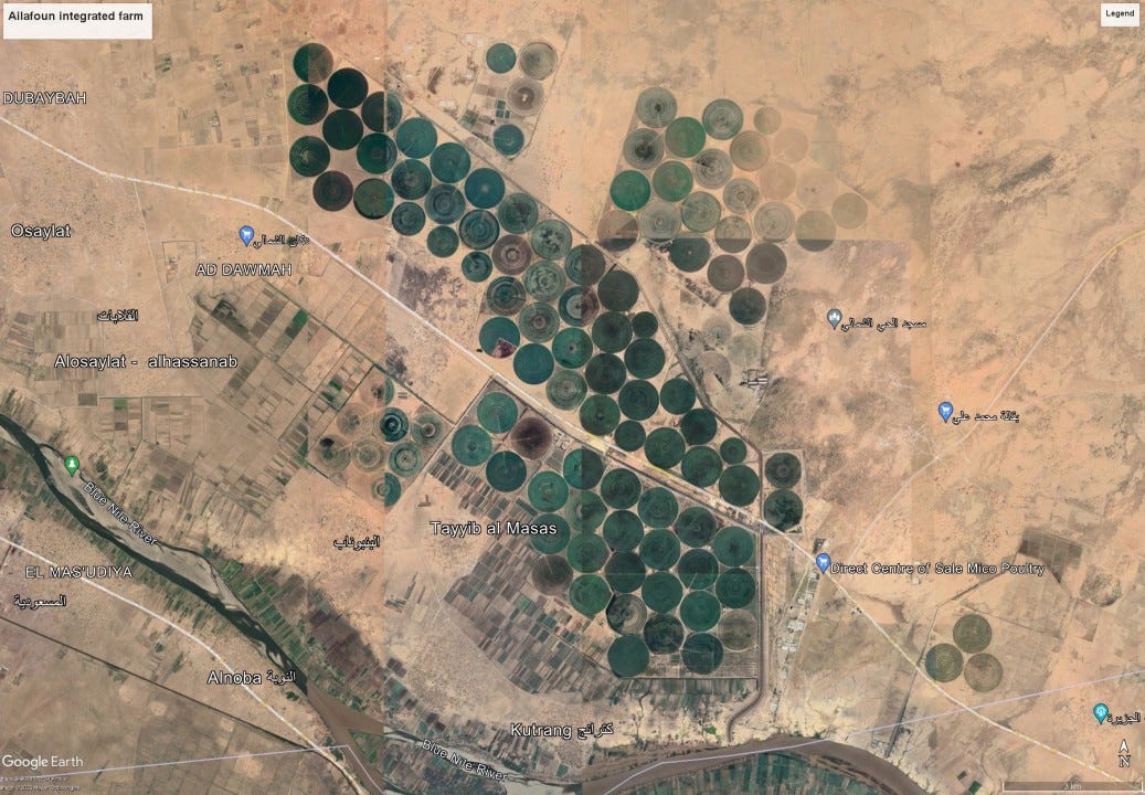
The Ailafoun Integrated Farm, located south of Khartoum, is a significant agricultural establishment covering approximately 500 hectares. It is part of DALGroup.sd and features various agricultural activities, including a large Holstein/Friesian dairy herd, a modern milking parlour, crop cultivation under centre pivot irrigation, controlled environment agriculture (CEA) for the production of vegetables, shrubs, ornamentals, and fruit trees, as well as fish production ponds for Tilapia Nilotica. The total area of the farm is approximately 130 square kilometres.
Unfortunately, on the 7th of May, satellite images revealed a visible fire at the Ailafoun Farm, likely due to ongoing combat events in Sudan.
Methodology
The use of advanced remote sensing techniques, such as the Sentinel Hub False Color Composite (FCC) and Short Wave Infrared Composite (SWIC), has been employed to detect and assess fire-affected areas in farming landscapes, enhancing the accuracy and efficiency of fire monitoring and analysis.
The false color composite (FCC) is commonly used to evaluate plant density and health, with plants reflecting near-infrared and green light while absorbing red. Cities and exposed ground appear as grey or tan, and water appears blue or black.
The Short Wave Infrared composite (SWIC) helps estimate the amount of water present in plants and soil. In this composite, vegetation appears in shades of green, soils and built-up areas are various shades of brown, and water appears black. Newly burned land reflects strongly in the SWIR bands, making them valuable for mapping fire damage.
Images Analysis

Comparing images from the 7th and 12th of May, it can be observed that the fire locations started along main roads, marked in blue squares.


Images from the 22nd of May, utilizing the Short Wave Infrared composite (SWIR), show newly burned land and visible smoke in the fields. A notable road can also be seen along the edges of the fields.

On the 1st of June, images reveal the presence of an orchard at coordinates (15.333160, 32.951497) within the farm. However, field data is required for accurate analysis. The last image, taken on the day of writing the report, indicates a loss of approximately 12 square kilometres.

Findings
The images alone are not conclusive in determining how the fire started or who started it. Field data is necessary to answer these questions accurately. However, the general sequence of the fire suggests a systematic infrastructure destruction, which aligns with news and media reports. Similar incidents have been associated with the militant group known as the Rapid Support Forces (RSF), also known as Janjaweed, since the 18th of April.
 | A guest post by
|