Map: Areas of Control in Central Sudan
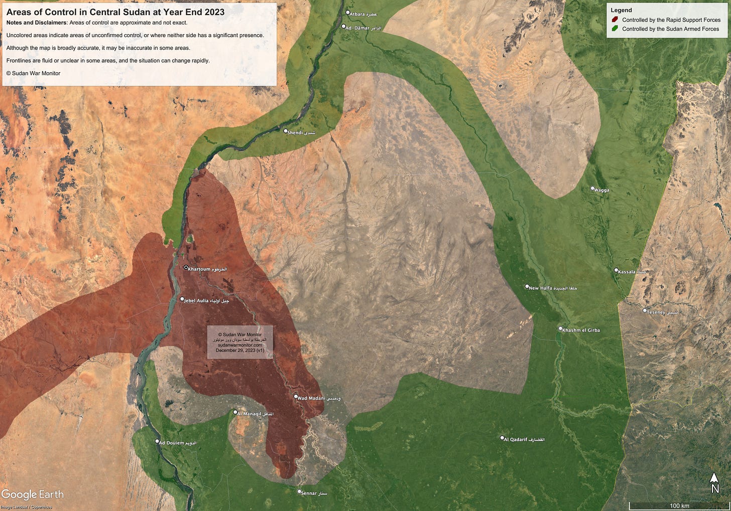
Updated map of Khartoum State, Gezira State, and surroundings
Despite its origins in western Sudan, the Rapid Support Forces (RSF) have gained control over large parts of the central part of the country. After eight and a half months of fighting, they now dominate most of the capital region Khartoum, as well as Jezira State and the northern part of White Nile State.
RSF forces have also ventured into rural parts of Gedaref State and River Nile State, without establishing a significant presence. Likewise, in Sennar State, the RSF have made some incursions along the border, though they have not attacked Sennar City.
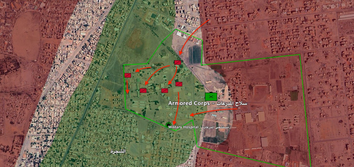
For their part, the Sudan Armed Forces (SAF) retain control over the northern half of Khartoum’s sister city Omdurman, as well as pockets of resistance in Khartoum itself. They have forces north and south of the capital, in eastern states, and in Red Sea State, which is now the home of the new de facto capital, Port Sudan.
Map Notes and Disclaimers
Red shading indicates areas controlled by the Rapid Support Forces, and green shading indicates areas controlled by the Sudan Armed Forces.
Uncolored areas are areas where control is unconfirmed, or where neither side has a significant presence. Uninhabited and uncultivated areas are generally left uncolored.
The map is based on three factors:
Geolocated videos of the forces of the two sides.
Qualitative data, such as credible news reports and social media reports.
Our independent assessment of the military situation.
Although the map is broadly accurate, it may be incorrect in some areas. In particular, the Jezira/Sennar/Gedaref front is new and emerging, and the map is quite approximate in that area.
Support our journalism
Our mapping, analysis, and reporting is made possible through the generous support of paying subscribers, donors, and volunteers. Please sign up for a paid subscription so that we can sustain our mission and continuously improve the quality of reporting. Thank you!


