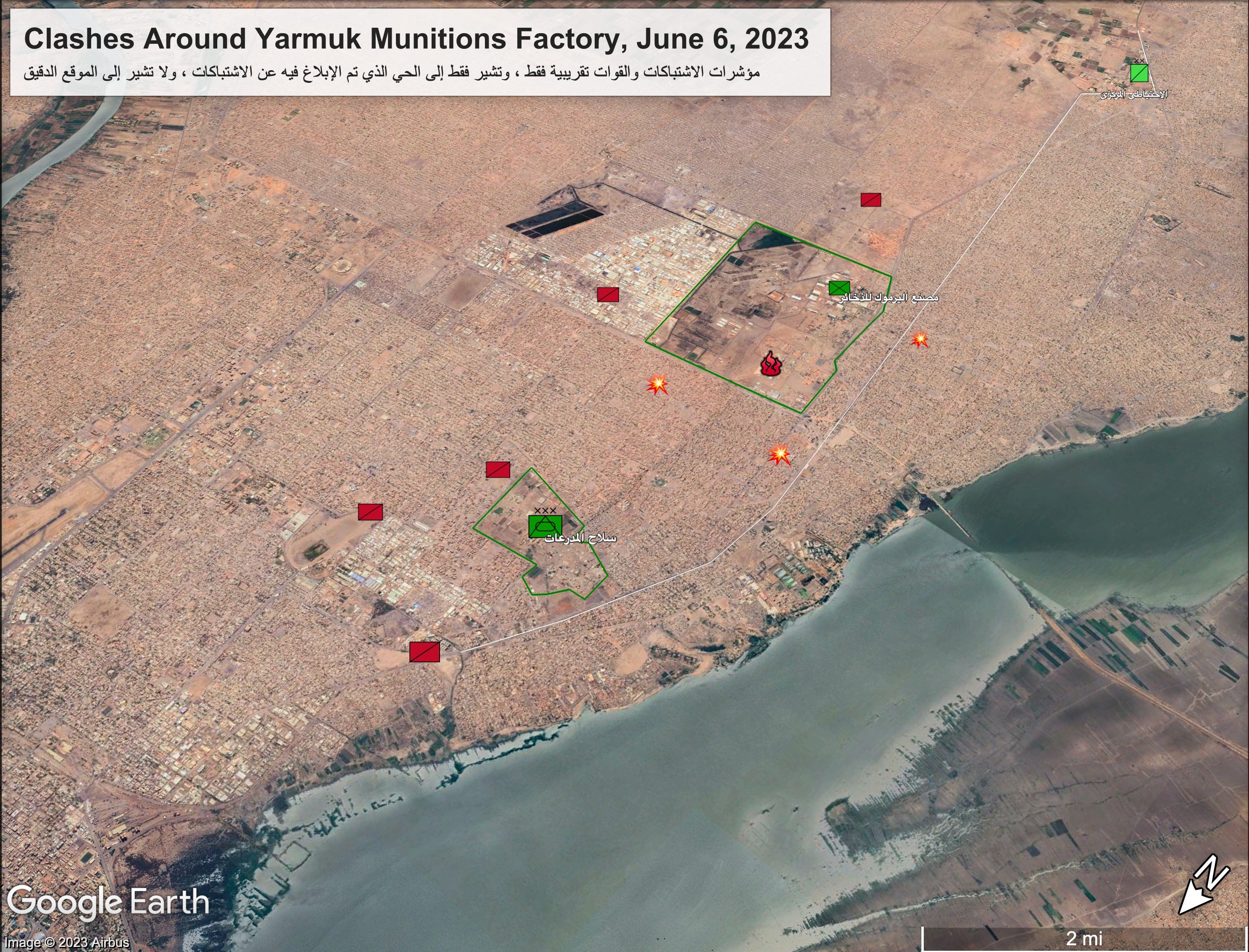
Clashes occurred around Yarmuk munitions factory in western Khartoum on Tuesday as the Sudan Armed Forces (SAF) and Rapid Support Forces (RSF) continued to battle for control of the capital.
The map above indicates general areas where clashes were reported June 6, as well as approximate disposition of forces. A few disclaimers:
The markers for the clashes are only meant to give a very general idea of where fighting took place. Reports of fighting may be inaccurate or false, though I wouldn’t have shared this if I didn’t think the information at least partly accurate.
The map is not meant to show the exact location of RSF forces.
The markers for the SAF positions, showing Armored Corps (left), Yarmuk factory (center), and a base of the Central Reserve Police (top right), are precise. However, SAF may also have positions and patrols outside of these areas.
The white line is Al Shijra Avenue, a key corridor, hitherto SAF-controlled, that connects the three SAF bases.
The fighting damaged a gas…