Rapid Support Forces attack al-'Aylafun
Clashes southeast of Khartoum
The Rapid Support Forces attacked the town of al-’Aylafun (العيلفون) yesterday afternoon, October 5, clashing with the Sudan Armed Forces for several hours, according to crowd-sourced social media reports and geolocated video.
The town is about 10 km south of the Soba Bridge and is the northernmost SAF-controlled territory along this part of the Blue Nile. Prior to the war, Al-’Aylafun was home to a military service camp, which SAF have likely built up in recent months.
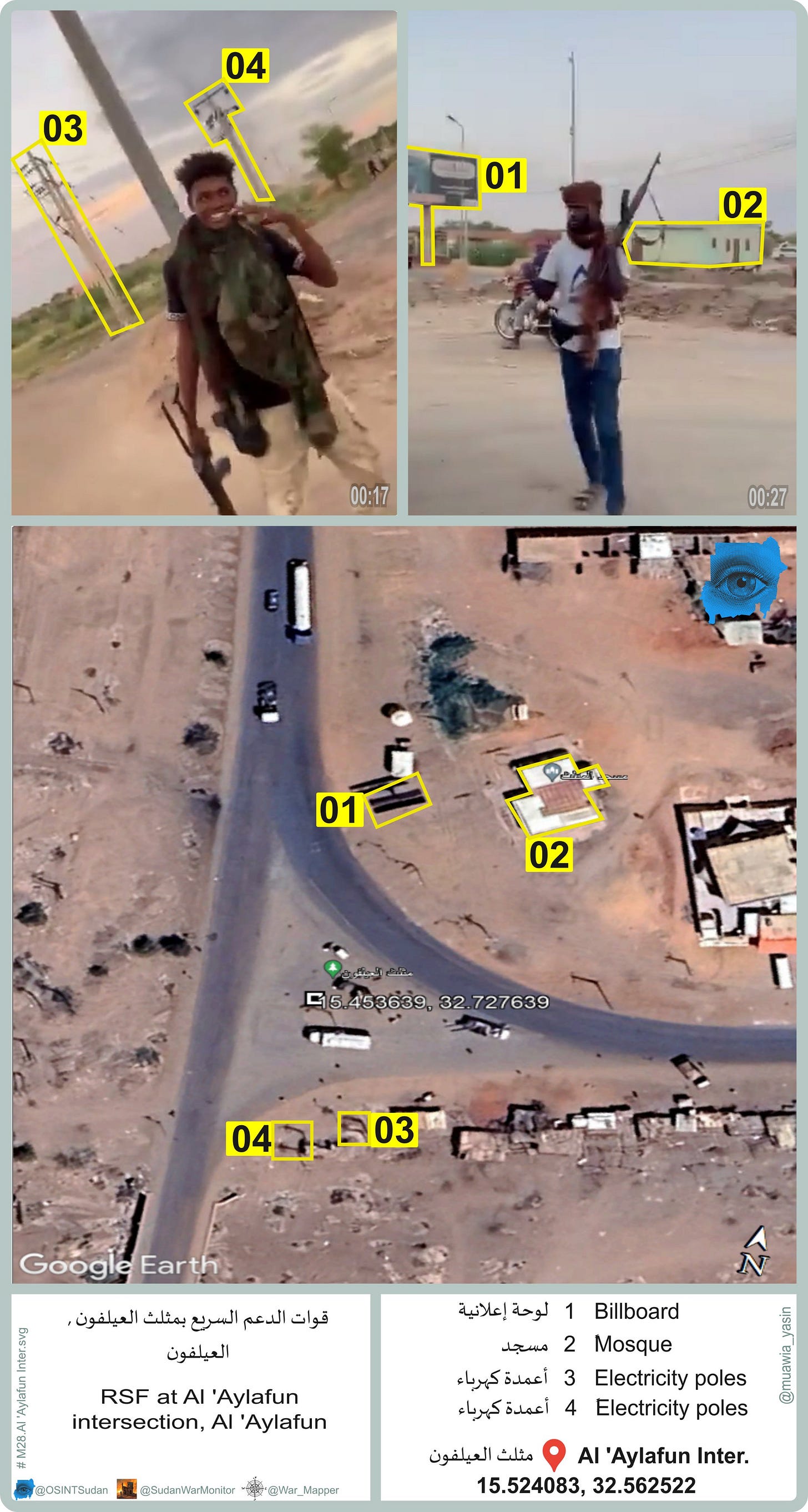
The below video shows the RSF using an armored car, pickup trucks, and motorcycles at the junction between al-Gatati and al-’Aylifun (15.453639, 32.727639).
According to the geolocation, the video was filmed on the north side of al-’Aylifun, whereas the military base is on the south side, so there isn’t any evidence yet that the RSF took control of the town or the military base.
However, they did apparently overrun some SAF defensive positions, as seen in this video (⚠️ graphic) that the speaker says was recorded in al-’Aylafun yesterday. It shows RSF at a captured SAF outpost. The beds and sandbags (1:22) make it clear that this was a defensive position, and there is one body in the video.
Another video shows the RSF with a prisoner in the back of a pickup, wearing civilian clothes. Finally, this video shows an RSF pickup loaded with fighters attempting to drive through a dirt roadblock. The caption says it is from al-’Aylifun, though it isn’t yet geolocated.
The attack on al-’Aylafun follows a gruesome airstrike in Soba just over a week ago, as well as at least one drone strike in East Nile. These attacks raise the possibility that al-’Aylafun is being used as a base of operations for surveillance and/or attack drones; that could have motivated the RSF attack.
Fighting in Kober
Fighting has continued in Khartoum Bahri around the besieged Signal Corps, a military base that, together with the nearby General Command, are among the last remaining Sudan Armed Forces positions in Khartoum and Khartoum Bahri.
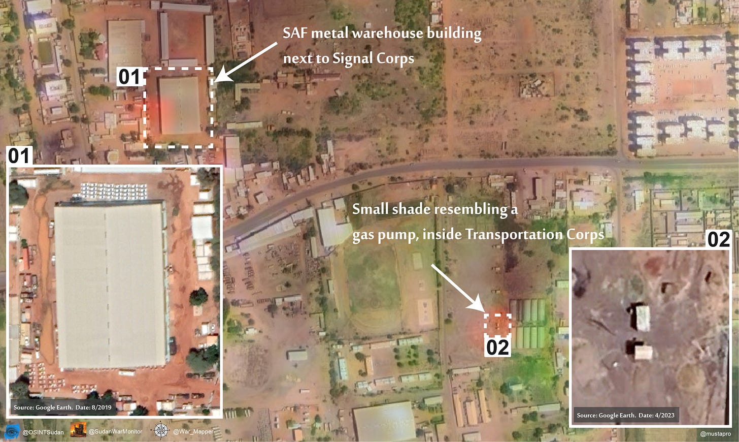
Videos from the area are few and far between. However, OSINT analyst Tom Bike noted these three fires on Sentinel satellite imagery for October 4.
According to our previous mapping of areas of control, the northernmost fire is in a contested area, and the southern two fires are in SAF-controlled territory. They are very likely therefore combat-related, due to clashes or RSF shelling.
The two southern fires appear to be a metal warehouse building at the SAF facility known as Transportation Corps, and a metal shade which resembles a gas pump.

RSF’s attacks against this area are part of a broader offensive in central Khartoum to capture the Armed Forces headquarters, where several senior army leaders are trapped, and which the RSF view as having symbolic importance.


