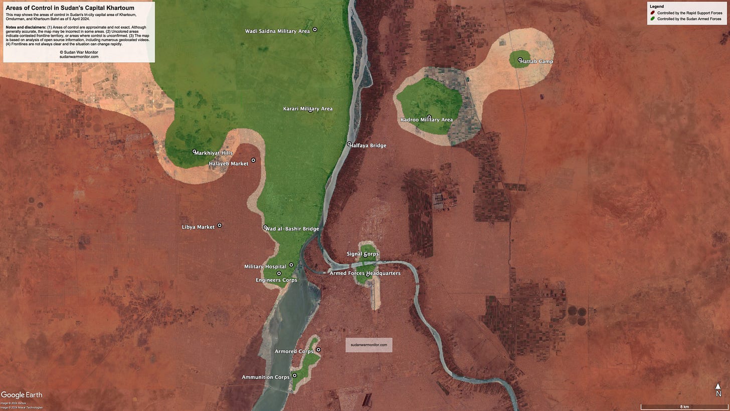
Map of the Areas of Control in Khartoum
SAF vs RSF control as of April 2024
Sudan’s civil war is approaching its one-year anniversary, a year that was marked by catastrophic fighting in the capital Khartoum and its sister cities Omdurman and Khartoum Bahri.
The fighting has killed tens of thousands of people, forced millions to flee, and devastated the nation’s economy, creating the world’s largest humanitarian disaster.
This map shows areas controlled by the two warring parties, the Sudan Armed Forces (green) and the Rapid Support Forces (red), in the capital region. It is based on analysis of geolocated videos filmed by combatants.
Both sides have consistently claimed that “victory is near.” But in the capital region, they are locked in a deadly stalemate. Early in the war, the Rapid Support Forces had the advantage in Khartoum, overrunning several military bases and surrounding others. More recently, the Sudan Armed Forces turned the tide in Khartoum’s twin city Omdurman, capturing large parts of the central city.
Hoping to build on that success, the Sudan Armed Forces are preparing an offensive from neighboring River Nile State to relieve their surrounded bases in Bahri, including Signal Corps, Kadroo, and Hattab. For their part, the Rapid Support Forces continue to dominate the capital itself, Khartoum, maintaining a siege of the Armed Forces headquarters and residential neighborhoods near the Armored Corps base.
The fighting has rendered parts of the capital uninhabitable, while residents who remain behind face shelling, aerial bombing, power outages, water shortages, and the risk that the frontline could move toward their homes.
Government institutions have largely relocated to Port Sudan, diplomatic missions evacuated the country, and thousands of homes and businesses were destroyed.


