
Sudan Military Retakes Sirkum and Mugaja in Blue Nile
Army advance follows a string of setbacks in Blue Nile
The Sudanese Armed Forces (SAF) on Monday recaptured the villages of Sirkum and Mugaja in Sudan’s southern Blue Nile region from the Rapid Support Forces (RSF), with videos circulating on social media and geolocated by Sudan War Monitor showing army troops inside both villages.
The army’s advance rolls back some of the gains made this month by the RSF and its ally, the Sudan People’s Liberation Movement-North (SPLM-N) led by Abdelaziz al-Hilu.
The two groups have been fighting under the banner of the Sudan Founding Coalition, or “Ta’asis,” across southern Blue Nile and South Kordofan.
A video geolocated by Sudan War Monitor places SAF troops inside Sirkum village at 10°44’28.43”N, 34°06’23.90”E. The site lies about two kilometres east of the Sirkum garrison, and there is no visual evidence indicating that government forces have re-entered the garrison itself.
Two other videos place government forces inside Mugaja garrison here (11°04’26.25”N, 33°53’39.92”E) and here (11°04’29.29”N, 33°53’43.07”E), where a military pickup truck is seen driving through the military garrison.
The footage confirms an army presence in both places, although it remains unclear how much ground government forces now hold.
The fall of the Sirkum garrison on June 20 marked one of the biggest gains by the RSF and SPLM-N in Blue Nile since the capture of Kurmuk in March. The garrison had served as one of the army’s defensive positions along the Sali-Dindiro road leading toward Damazin.
Sudan War Monitor could not determine whether the army has also retaken the base.
In a statement issued on Monday, the Sudanese military said its forces and allied units had “liberated the areas of Maqjah and Sorkom,” using alternate spellings for Mugaja and Sirkum. The army said it had destroyed military equipment belonging to the RSF and killed a large number of its fighters.
“Continuing their victories along the Blue Nile axis, the Sudanese Armed Forces, together with supporting forces, have liberated the areas of Maqjah and Sorkom.”
“Our forces inflicted heavy losses on the militia in equipment and neutralized a large number of its fighters. Clearance operations and the pursuit of the enemy are continuing in order to secure the liberated areas, ensure stability, restore security, protect civilians, and provide essential living needs,” the statement said.
The RSF did not issue a statement and Sudan War Monitor could not independently verify the army’s claims regarding casualties or equipment losses.
Sirkum lies about 11 kilometres southwest of Sali in Kurmuk locality, along one of the roads leading toward Dindiro and the state capital, Damazin. Mugaja lies farther west in Bau locality and was among the areas seized earlier this year during the RSF-SPLM offensive.
The fighting has displaced tens of thousands of people across Blue Nile State. According to the International Organization for Migration, nearly 60,000 people had fled their homes by late May, with Kurmuk locality accounting for roughly half of the new displacement. Many of those uprooted by the fighting moved toward Damazin and other towns farther from the front lines.
IOM has linked recent displacement to insecurity in villages along the same axis as Sirkum and Sali, including Dokan, Kereng Kereng, Khor Hassan and Abego. Across Blue Nile State, more than 371,000 people were living in displacement as of May, most of them sheltering outside formal camps.
Videos
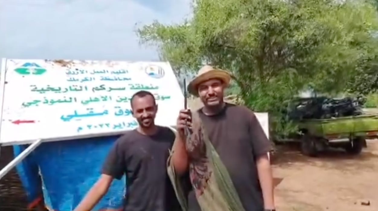
In this video, elements from the Sudanese militiary are seen in Sirkum village here (10°44’28.43”N, 34°06’23.90”E), which is about 2 kilometers to the east of the Sirkum army garrison.
In the below video posted on Telegram by a pro-Sudanese army channel, Sudanese army soldiers are seen inside Mugaja garrison at 10°44’28.43”N, 34°06’23.90”E. A burned-out pickup truck is also visible in the footage, possibly the result of a drone strike.